A very potent pattern is setting up for the eastern United States and that means more active weather and a crazy week of snow for much of Ohio. Unfortunately, we’re stuck in the “dumb cold” part for much of it too. An active Arctic Jet and plenty of cold air thanks to a split polar vortex will keep things humming in the winter department into early March. Strap in folks, it’s going to be a wacky week…. and maybe even longer than that!
Crazy Week of Snow Round One – Sunday through Tuesday
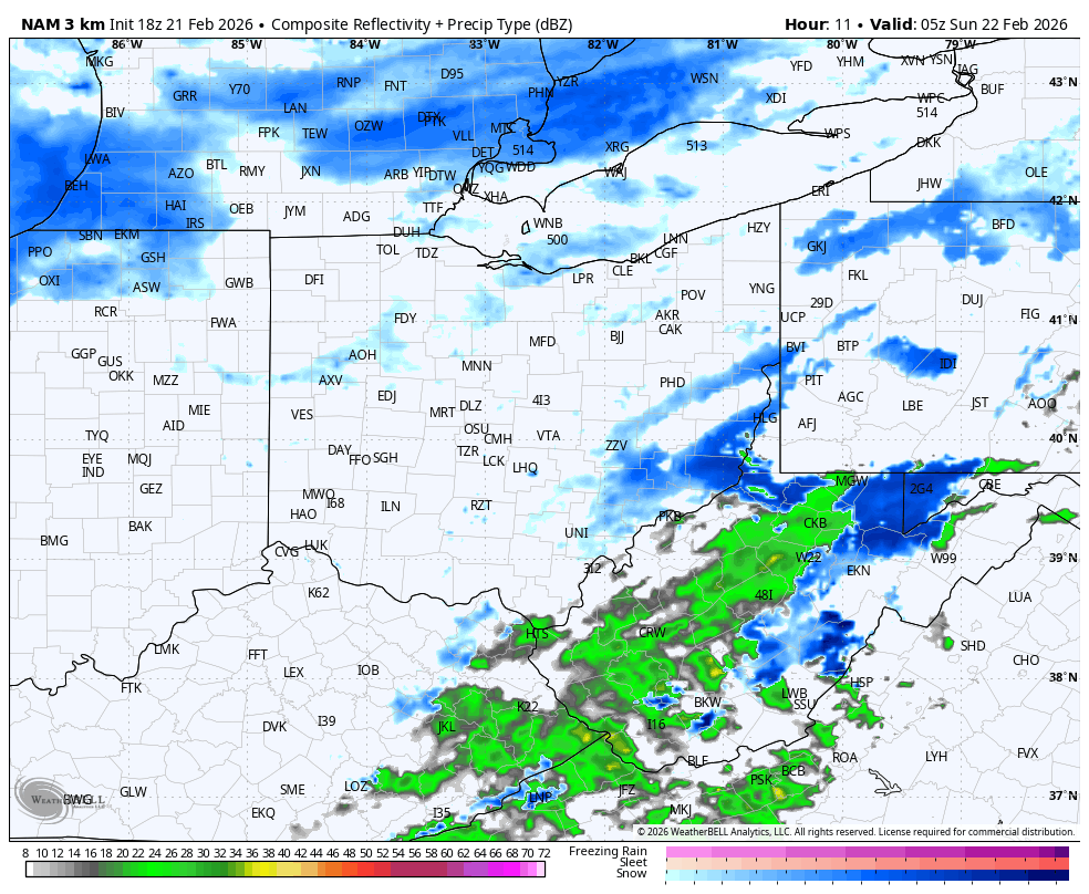
Things kick off Sunday with a system dropping across Ohio, with light to occasionally moderate snow. Lake Erie is back open in spots and the upstream lakes still have plenty of open water so lake enhanced and lake effect snow are all on the table and will come into display during this first round. Gusty northwest winds will aid in restricting visibility with blowing and drifting snow possible. Surface temperatures won’t be super cold – mid/upper 20s to around 30 – but aloft will be plenty cold for a pretty efficient snowfall.
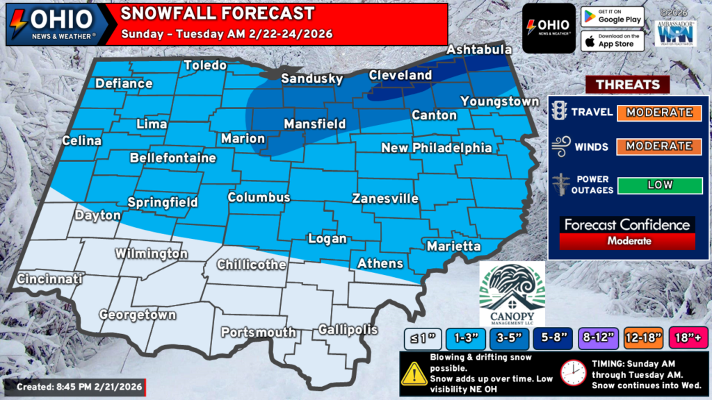
How Much Snow to Expect
Some parts of Ohio, notably Southwest and South Central Ohio, won’t see much snow. Around 1″ of snow is possible here, with a few spots coming in just over 1″. Elsewhere, 1-3″ of snow is possible for a good portion of Ohio. Higher totals can be expected across parts of Northern Ohio and into the snowbelt in Northeast Ohio. 3-5″ outside of the snowbelt will be common with 5-8″ or a little more where snow showers persist in the snowbelt. Here is our latest forecast:
Crazy Week of Snow – Round Two
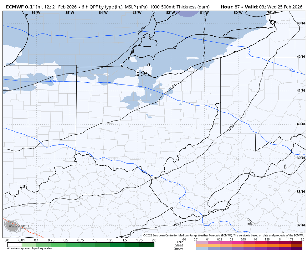
As if that wasn’t enough, snow continues into Tuesday across Northern Ohio, although a break in the action is possible. Another system will move in from the North early Wednesday with additional snowfall possible across much of Ohio. Amounts here will be light for many but will likely bring a few additional inches of snow across Northern Ohio as some lake effect snow looks to set up by Wednesday afternoon.
Crazy Week of Snow – Round Three
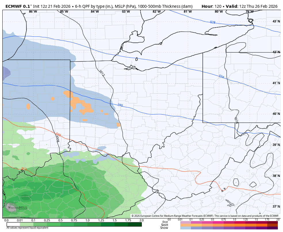
And if that wasn’t enough for you, don’t worry THERE’S MORE! A more potent system is possible on Thursday that could bring several inches of snow to the northern half of Ohio with rainfall to the southern half of the state. However, we still have time for this particular system to refine itself and it could go either way – more snow or more rain for Ohio.
March to Start Like a Lion?
And if that wasn’t enough for you, don’t worry! March isn’t looking to start much better than February ended. At least a couple more rounds of snow look possible during the week of March but a lot of this could change. There are some hints as temperatures warming up enough to be above freezing, which would mean rain instead of snow. However, this may not be true for all of Ohio as cold air will hang out just north of us and it does not take much to tap into that and drag it across at least the northern part of the state. Hopefully, things will improve after the first week of March and we’ll start to trend warmer so we don’t miss out on Spring… again.
Stay up to date on the latest weather alerts! Download our FREE Ohio News and Weather app on the Apple App Store and Google Play. Plus stay up to date on the threat for severe weather across Ohio on Tuesday by following us on social media.