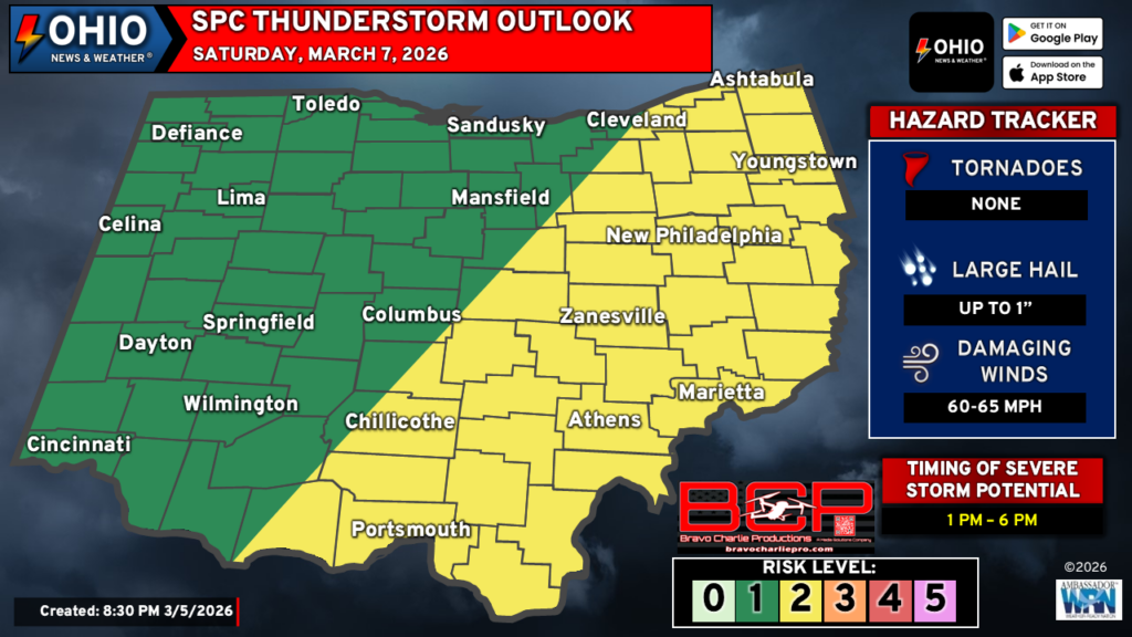
Severe weather is possible in Ohio on Saturday as a strong cold front moves across Ohio by Saturday evening. The best potential for severe weather is across Eastern Ohio, generally east of I-71. Damaging winds are the biggest threat.
The Details – Severe Weather in Ohio
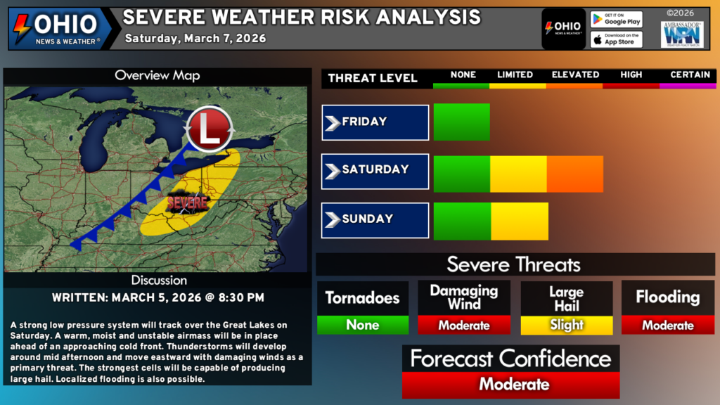
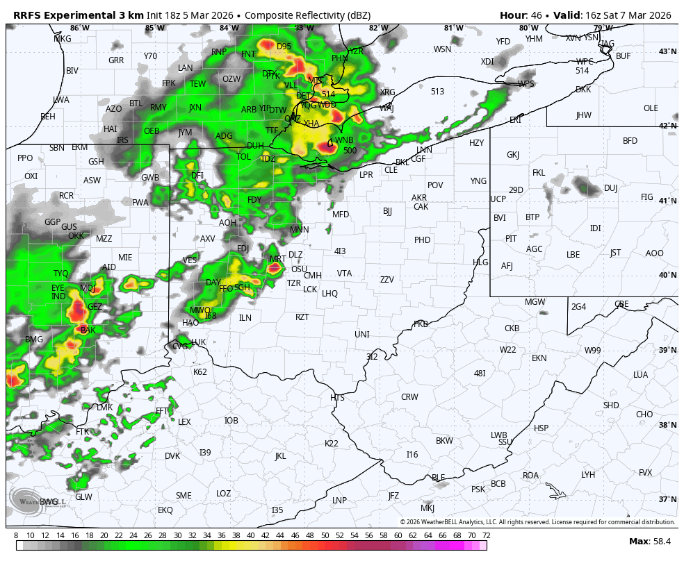
A low pressure system will track over the Great Lakes on Saturday. A cold front will trail behind it and move into Ohio by late Saturday afternoon. Ahead of this front, it will be spring-like with temperatures in the low 60s to low 70s. Plenty of moisture thanks to all the rain we’ve seen as of late and some sunshine will help to create some instability. Additionally, strong winds aloft will also aid in the development of thunderstorms by midday. The potential for strong to severe storms will exist from approximately 1-6 PM across Eastern Ohio.
Severe Weather Threats
- Damaging wind gusts in excess of 60 MPH is the main threat from these storms.
- Large hail is possible with the stronger cells.
- While we have outlined a no tornado risk, this could change to an isolated tornado. Current data makes the threat very uncertain for Ohio. Western Pennsylvania currently poses an isolated tornado risk as storms will move into the state from Ohio and continue to mature.
Concerns
As with any severe weather event, everything needs to come together just right for the event to even begin, let alone fully occur. While warm temperatures and plenty of moisture will already be in place, any sunshine we can manage to see would aid in the development of thunderstorms. Further, should the entire system slow down as it moves into Ohio, this could allow for storms to develop further west and bring bigger changes to the forecast. Should this occur, it could introduce a isolated tornado risk for parts of Ohio but it will also likely mean a better organized setup compared to what is shown above.
Outside of the standard severe weather risks, flooding is also a concern. With all of the recent rain, the ground is well saturated and flooding is also been and on and off issue in some spots. Additional heavy rainfall will only make those problems continue and perhaps worsen to an extent.
Summary
Severe Weather is possible in Ohio on Saturday, mainly in the afternoon hours for areas east of I-71. However, it is possible that the slight risk area could extend westward should storms organize sooner and/or the entire system slow down. If this occurs, there could be an isolated tornado risk for Ohio. Otherwise, damaging wind gusts in excess of 60 MPH and large hail up to 1″ in diameter can be expected from any severe thunderstorm.
We will continue to monitor the latest model data and trends and provide further updates throughout the day on Friday.
Stay up to date on the latest weather alerts! Download our FREE Ohio News and Weather app on the Apple App Store and Google Play. Plus stay up to date on the threat for severe weather across Ohio on Tuesday by following us on social media.